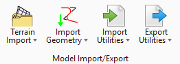
Model Import/Export
Ribbon: Home
|
Setting |
Description |
|
Create Terrain Model from File - Create a terrain model by importing from an external file. Numerous file formats are supported such as LandXML, Lidar (*.las), and legacy products (InRoads, GEOPAK, and MX). Create Terrain Model from Ascii File - Create a terrain model from 2D graphics which also contain an elevation label. Create Terrain Model from Elements - Create a terrain model from 3D graphical elements. Create from Point Cloud - Create a terrain model from MicroStation Point Cloud data. Create Clipped Terrain Model - Create a terrain model by clipping an existing terrain model and providing an optional horizontal or vertical offset. Create Complex Terrain Model - Create a new Complex terrain model by merging/appending multiple terrain models. Edit Complex Model - Edits a complex terrain by changing the order of merging, change merge or append methods and add or remove component terrain models. Create Delta - Create a new terrain model by the difference between 2 terrain models or a terrain model and a plane (elevation). Create by Text Interpolation - Create a terrain model from 2D graphics which also contain an elevation label. Create Corridor Alternate Surfaces - Create a terrain model from user-specified points in a corridor model along any given path. |
|
|
Import Geometry - Import geometry elements that are stored in the cogo databases if they are MX (FIL), InRoads (ALG or FIL), or GEOPAK (GPK )elements. Import Horizontal Geometry from Ascii File - Import horizontal geometry element from an ASCII file via a text wizard. Import Vertical Geometry from Ascii File - Import vertical geometry element from an ASCII file via a text wizard. |
|
|
Import Haestad Model - Imports another model into your project. Import Haestad Submodel - Imports another model, or any portion thereof, into your project. Import SWMM v5 - Imports a system that has been saved in SWMM v5 format. Import LandXML - Imports a model from a LandXML format .xml file. Import MicroDrainage - Imports a model from a MicroDrainage .sws / .fws / .ews / .mdx file. Import InRoads - Imports an InRoads file into your project. |
|
|
Export Haestad Submodel - Exports any portion of a model as a submodel for import into other projects. Export to SWMM v5 - Exports a system as a SWMM v5 format. Export LandXML - Exports a model to LandXML format. Export MicroDrainage - Exports a model to MicroDrainage .sws / .mdx format. Export Excel - Exports a model to Excel. |


