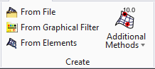
From File
 Used to create a TM by importing from an external file type.
You can access this tool from the following:
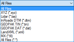
The following formats are supported for import:
The import process supports multiple files of the same type to be imported at once. The import settings that are defined are generic to all files selected for import.
Import Terrain Model dialog
The Import Terrain Model dialog is modal form and does not allow interaction with the graphics environment once open.
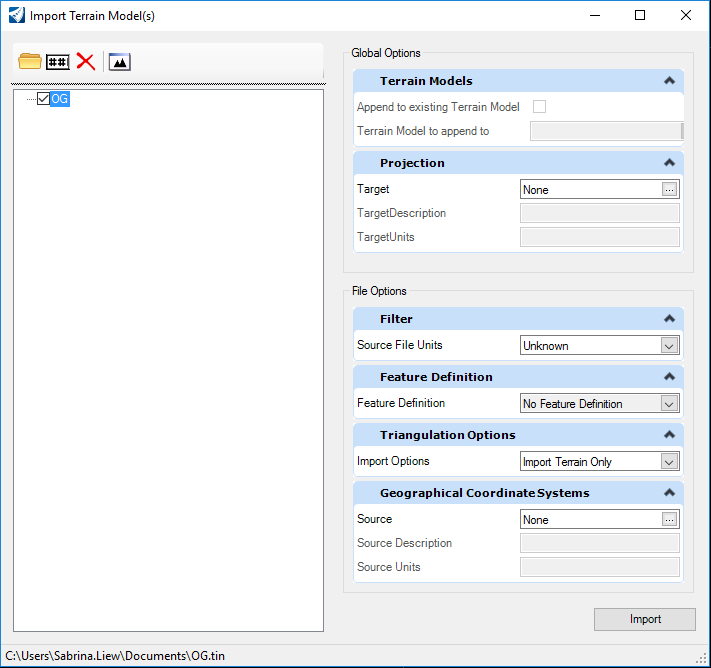
Four tools are supported in the upper left corner of the dialog:
|
Setting |
Description |
|
Select Files to Import |
Displays the Select Files to Import dialog. |
|
Rename Terrain Model |
Renames the specified Terrain Model. |
|
Remove Terrain Model |
Removes the specified Terrain Model from the listing. Note it does not delete the terrain model. |
|
Fit View |
Places the entire specified Terrain Model within the active view. |


Several options are supported in the right pane of the dialog:
-
Terrain Models - options if there is already a terrain model in the active *.dgn file and how to combine with the data to be imported.
-
Projection -
-
Filter - Filtering may be a useful option for large datasets.
-
Feature Definition - feature definition to be used for imported terrain. If none is selected, the terrain model is drawn using the active symbology.
-
Triangulation options - specifies how to address the external triangles of the created Terrain Model
-
Geographical Coordinate Systems (GCS) - If the software can determine the geographical coordinate system of the file to be imported, the fields are populated. If set to Unknown, the software uses the MicroStation design units. This section is used if the resultant terrain model needs to be in a different GCS.
Terrain Models
|
Tool Setting |
Description |
| Append to existing Terrain Model |
When toggled on, appends to the selected Terrain Model in the *.dgn. When toggled off, a new terrain model is created, ignoring any other Terrain Models in the active file or referenced. |
| Terrain Model to append to |
Type the Terrain Model name or Select from the list of available Terrain Models. Available when Append to existing Terrain Model is selected. |
Projection
Filter
Note the settings in this section vary depending on the file type of the source data.
Select to reduce the number of data points imported to the TM then enter the Maximum Number of points value in the field provided.
|
Tool Setting |
Description |
|
Source File Units |
If the software can determine the units from the data file, this field is populated. If it cannot determine the units, Unknown is displayed. The user can specify Unknown, Millimeters, Centimeters, Meters, Kilometers, Inches, Feet, US Survey Feet, Miles. If Unknown, then the design file units are used. |
For details on filtering, see Filtering.
Feature Definition
|
Tool Setting |
Description |
|
Feature Definition |
No Feature Definition is default. Select from drop down menu the feature definition. |
|
Import Options |
Creates design file elements according to the styles defined in the source file. The DGN is scanned and the first 15,000 elements found are added to the rule that is attached to the terrain model that gets created. Changing one of these elements affects the terrain model. All other elements found in the DGN are added into the terrain model but not added to the rule. Changing one of these elements does not affect the terrain model. A warning displays in the Civil Message Center if the limit is reached. Import Both - Creates terrain with features. |
Triangulation Options
|
Setting |
Description |
|
Edge Method |
No removal - No external triangles are removed. Sliver - Long, thin triangles are dissolved based on a formula hard coded within the software. Side - External triangles whose external edge is longer in length than a user specified distance are removed. The side option does not apply to internal triangles, only those on the edge of the model. |
Geographical Coordinate Systems