Terrain
Terrain is an element selection and terrain modeling tools. A terrain model is a set of triangles mathematically computed from point data collected from the surface being modeled. They are typically used to model highly irregular surfaces, like the surface of the earth. A terrain model is created from 3D features such as points, breaklines, and contours.
Terrains Models (TM) play a key role in Infrastructure and Mapping workflows. The data collection methods underlying these models are ever increasing in detail and coverage therefore resulting terrains need to be accessible across a variety of Infrastructure and Mapping workflows.
Data in a variety of formats including raw graphical elements 2D and 3D can be provided for consumption into the terrain model. The existing ground terrain model can also be used as the starting point for the creation of a proposed design terrain model using the Corridor Modeling tools.

Terrain models are also referred to as digital terrain models (DTMs), triangulated irregular networks (TINs), or triangulated surfaces.
Create
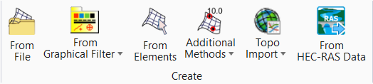
The Terrain Model Create tool group contains tools to create a terrain model from graphical elements, ASCII files, point clouds, LandXML, and importing from various Bentley Civil products. Tools are also supported to merge together two or more models, and to clip models.
| Setting | Description |
|---|---|
| From File | Allows you to import terrain model from file. |
| From Graphical Filter | Allows you to create terrain model from graphical filter. |
| From Elements | Allows you to create terrain model from elements. |
| Allows you create terrain using additional methods. | |
| Topo Import | Allows you to import terrain from ESRI terrain layer. |
| From HEC-RAS-Data | Allows you to import HEC-RAS- Surface Data. |


Edit
| Setting | Description |
|---|---|
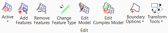
| Set Active |
Set Active - Allows you to set active terrain model. Clear Active - Clears the active terrain model. |
| Add Features | Adds more features into the terrain that was created using the create commands. Example, create the terrain from break lines, then add points. |
| Remove Features | Removes elements from a terrain which were added by Add Features or Create from Elements. |
|
|
Allows you to update the existing features. |
| Edit Model | Opens tool settings with several simple editing tools; delete, insert and move vertex, delete triangles, and swap lines. |
| Edit Complex Terrain Model | Edits a complex terrain by changing the order of merging, change merge or append methods and add or remove component terrain models. |
| Boundary Options | Allows you to add or remove boundary. |
| Transform | Capable of Translating, Rotating, and Scaling an element. Can do all three modifications on regular or civil elements at once. |


Analysis
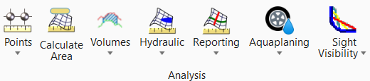
The Civil Terrain Model Analysis tool set contains tools to compute volumes, display coordinates, elevations and other data about points or between points on the model, and analysis of ponds, watersheds.
| Setting | Description |
|---|---|
| Points | Allows you to analyze the points. |
| Calculated Area | Allows you to calculate the area of terrain. |
| Volumes | Allows you to create, cut, and analyze volume. |
| Hydraulic | Allows you to create, cut, and analyze ponds. |
| Reporting | Contains tools for reporting conflicting features and reporting source data used to create the terrain model with duplicate points. |
| Aquaplaning | Contains tools for evaluating potential for a vehicle to lose control on wet road and adding flow lines. |
| Slight Visibility | Analyzes sight distances along an alignment or a corridor's control alignment based on specified design terrain or a corridor's top mesh and an optional existing surface or mesh. |


Miscellaneous
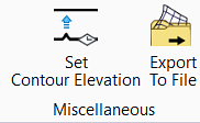
The Terrain Model Miscellaneous tool group contains some reporting tools, set up for graphical filters, labeling and exporting tools.
| Setting | Description |
|---|---|
| Set Contour Elevation | It allows users to
batch-process a set of contours and assign them to the proper elevation. Simply
place a line across the contours.
Each intersected contour line will automatically adjust to a calculated elevation value. Ideal for transforming 2D topographic data into 3D landscape. Please ensure your lines intersect for accurate elevation assignment. |
| Export to File |
Allows you to export the terrain model to file. The terrain model can be exported to: |

Labeling
| Setting | Description |
|---|---|
| Label Terrain Contours | Place additional labels for elevation on selected contours. |
| Label Terrain Spots | Label elevations at specific locations on the terrain model. |