3D
|
Setting |
Description |
|
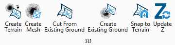
Create Terrain is used to create a digital terrain model to represent a stratum found in the boreholes. |
|
|
Creates a 3D mesh from the selected lithology. |
|
|
Cut From Existing Ground is used to cut a terrain model with another terrain model. |
|
|
Creates a terrain model using the tops of the boreholes. |
|
|
Snap to Terrain allows borehole to be moved to match the selected terrain elevation. |
|
|
Update Z is used to update the information stored in the database when the boreholes elevation has been changed. |


