Tool Settings
Once selected, the Road Placement settings dialog displays to define different parameters of the road to be placed.
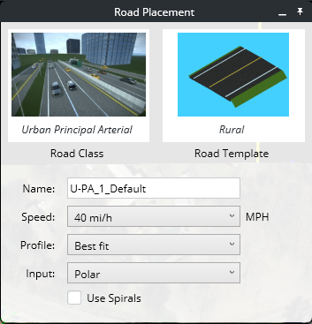
Road Class
Prior to designing your road, select a road class (default is Urban Principal Arterial). There are three main functional classes as defined by the United States Federal Highway Administration (FHWA): arterial, collector, and local. From these functional classes are subgroups.
The design criteria are defined with the AASHTO standards.
Available road classes:
- Freeways
- Interstates
- Rural Local Road
- Rural Major Collector
- Rural Minor Arterial
- Rural Minor Collector
- Rural Principal Arterial
- Urban Collector
- Urban Local Road
- Urban Minor Arterial
- Urban Principal Arterial
Reference: AASHTO. A Policy on Geometric Design of Highways and Streets, 6th Edition, 2011, Chapter 1 Highway Functions.
Road Templates
Click on Templates to open the Templates dialog to select a template to be used.
Refer to this section for details.How to Use the Library Picker.
Name
Road name can be specified in this field. A default name is always specified (incremental number) so every road has a unique name.
Speed
Design speed of the road. The drop down list specifies the speed. Miles per hour (MPH) or Kilometers per hour (Km/h) are used based on the Set Display Units selected in the settings section. By default, the speed is set based on the selected road class.
Corresponding Design Speeds in Metric and U.S. Customary Units
|
Metric |
U.S. Customary |
|
Design Speed (km/h) |
Corresponding Design Speed (mph) |
|
20 |
15 |
|
30 |
20 |
|
40 |
25 |
|
50 |
30 |
|
60 |
40 |
|
70 |
45 |
|
80 |
50 |
|
90 |
55 |
|
100 |
60 |
|
110 |
70 |
|
120 |
75 |
|
130 |
80 |
Reference: AASHTO. A Policy on Geometric Design of Highways and Streets, 6th Edition, 2011, Chapter 2 Design Controls and Criteria.
Profile
By default, the Best Fit option is selected and the road will be created with the best fit on existing ground vertically. Selecting the Straight option from the Profile drop down menu will create the road by placing a straight line between the PI. The terrain profile will be ignored.
Input
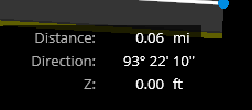
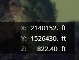
Places the road with either polar or cartesian input coordinates.
Use Spirals
If checked, the system will automatically create spirals when necessary, based on design speed.