Note: Select a link to
"jump" to the desired
Site group.

Site
ribbon
The Site ribbon is collection of interactive and
simplified tools capable of drawing intelligent layouts.
Site tabs have collection of tools listed below:
- Draw basic
- SITEOPS File Import
- Layout
- Grading
- Annotation
- Tables
Site tools also helps for Quick re-position buildings,
modify parking areas, and add driveways and sidewalks while evaluating the
results in real time.
New to OpenSite tools? LEARN more with the help of our
Introduction to OpenSite Designer
Course.
Draw Basic
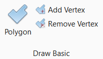
Draw Basic
group
|
Setting
|
Description
|
|
Polygon
|
Allows you to
draw a closed polygon.
|
|
Add Vertex
|
Allows you to add vertex to
existing polygon.
|
|
Remove Vertex
|
Allows you to remove existing
vertex.
|
Import

Import
group
|
Setting
|
Description
|
|
Import SiteOPS
File
|
Imports SITEOPS files (.soz) or SITEOPS XML
files (.xml) exported from the SITEOPS online versions.
|
Layout
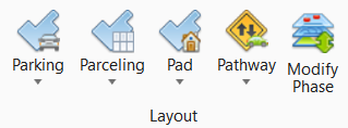
Layout
group
|
Setting
|
Description
|
|
Parking Lot
|
The Parking section of the Site Layout tab is a
collection of tools used to create and manage dynamically generated parking
layouts. An optimized parking layout is automatically generated using area and
side properties of a Parking Lot area. You can then customize the layout using
the other tools to suit design requirements.
- Parking Lot
- Creates a polygon area that automatically generates an optimized parking
layout using the properties of the area and sides.
- Parking
Direction - Allows the direction of parking aisles to be altered for
each parking area.
- Space
Point - Allows control of width for individual or a series of adjacent
parking spaces.
- Bay Point
- Allows control of parking and median settings for individual parking bays.
- Aisle Point
- Allows control of parking and median settings for individual parking bays.
- Island
Point - Allows control of placement and width of islands in the bays of
an automated parking area.
|
|
Parceling
|
Parcel design is automated with the use of a
Parceling Area and user drawn Driveways or by using a Parcel Block and a Parcel
Divider.
- Parceling
Area - Defines an area for parcel design.
- Parcel
Block - Creates a polygon area that acts like a parent parcel that can
be subdivided automatically using a Parcel Divider.
- Parcel
Divider - Creates a line that automatically divides a Parcel Block.
|
|
Pad
|
The Pad section of the Site Layout tab is a
collection of tools used to create and manage various types of parametric pads.
- Building Pad -
Creates a polygon area that represents a building pad. Buildings can be
customized using the properties of the area and sides.
- Other Pad -
Creates a polygon area that represents a generic pad with properties that can
be modified to represent many different pad types.
|
|
Pathway
|
The Pathway section of the Site Layout tab is a
collection of tools used to create and manage Driveways, Sidewalks and Driveway
connections.
- Driveway -
Creates a linear element with properties that control its material and grading
characteristics.
- Sidewalk -
Creates a linear element with properties that control its material and grading
characteristics.
|
|
Modify Phase
|
Allows you to change the design phase of
objects from conceptual to Preliminary or Final design.
|
Grading
Grading
group
|
Setting
|
Description
|
|
Limits of Disturbance
|
Creates a boundary for the proposed surface
grading.
|
|
Grading Solver
|
Launches a process where the conceptual layout
is converted into a 3D model and the grading is optimized for cost.
|
|
Problem View
|
Displays a graphical analysis of the optimized
site grading.
|
|
Draped Breakline
|
Creates a linear element that breaks the
existing TIN surface and sets interpolated elevations along the line.
|
|
Profiles
|
Used to generate a View that presents a desired
feature in profile thus enabling the Vertical Geometry tools to interact with
the chosen feature.
|
|
Constraints
|
- Constraint Area
- Creates a polygon area element with properties that control the slope
characteristics within the area.
- Constraint
Direction - Assigns a direction for slopes within the Constraint Area.
- Borrow Area -
Create an area that can be used for cut if the site grading optimization needs
to cut.
- Fill Area -
Create an area that can be used for fill if the site grading optimization needs
to fill.
|
Annotation
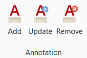
Annotation
group
|
Setting
|
Description
|
|
Add Annotation
|
Allows you to annotate the selected element.
|
|
Update Annotation
|
Allows you to update the
annotation for selected element.
|
|
Remove Annotation
|
Allows you to remove the
selected annotation.
|
Tables
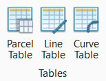
Tables
group
|
Setting
|
Description
|
|
Parcel Table
|
It provides you information on the parcel in
the parceling area. The area can be in square meters.
|
|
Line Table
|
It provides you information on
number of lines in parceling table.
|
|
Curve Table
|
It provides you information on
the curves in parceling table.
|


