Sample
Dataset
New in gINT Civil Tools Pro and gINT Civil Tools Pro Plus
is a sample dataset which contains:
Lithology:
- The cylinders are smaller
than in previous datasets and levels have new colors
- Materials and depth has
been revised
- A new display style,
"gINT: Coarse / Fine", displays the data based on coarse or fine material type
Sample:
- Now with n-value
calculation
- A new display style,
"gINT: N-Value", displays the data with a color gradient based on n-value
Water Level:
- Now with no identifier
(not mandatory for depth-only data)
- Only one type of water
level (at drilling and after drilling is removed)
EnvClasses:
- A definition of
environmental data using the "numerical option", data is loaded on 4 levels
based on the concentration (0-15, 15-30, 30-45, 45+)
EnvLog:
- A definition of
environmental data using the proportional size with logarithmic, data is loaded
on one level based on table name, and creates disks with size proportional to
concentration using a log factor
Loading
Data
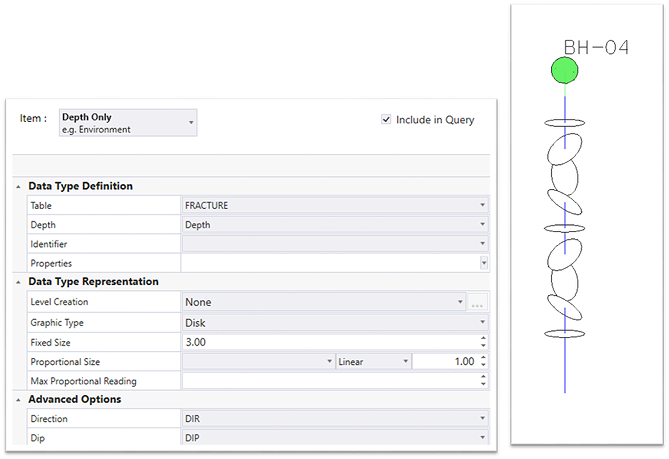
Oriented Display for Fractures
- Depth only data can be
represented as cylinders with orientation
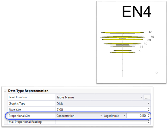
Environmental Readings/Logarithmic
- Proportional elements can
now be with a value using a log (log10) and not a linear factor
- Allows for creating
visible elements with difference in size but not huge ones
New Data
Type
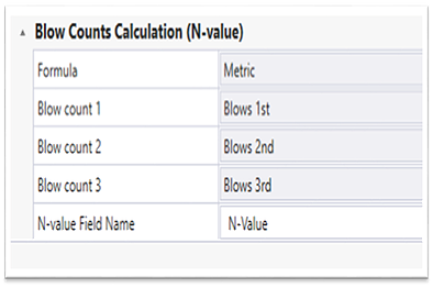
N-value Calculation
- Typically not stored in a
gINT project
- Loaded on elements at
import time
- Definition and
representation (for refusals) are the same as gINT
- Optional for items with
top and bottom depth (length)
- 3 formulas: metric,
imperial and AGS
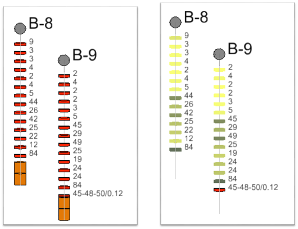
N-value Calculation: Example
- Left: Samples Loaded with
annotation of the N-value
- Right: a display style is
applied to the view. Elements are colored with a gradient from yellow to brown
based on n-value. Rock Core samples are not displayed
- Refusal in red
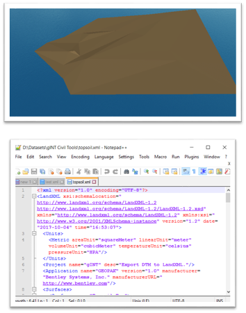
Interoperability
Export to LandXML
- Works with selected
terrains (MicroStation terrain elements)
- Exports to LandXML
3D Modeling
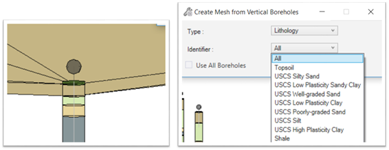
Create Mesh
- Creates meshes from top
and bottom using depth-bottom item
- Can work on individual
data types (one layer at a time)
- Can work on all data types
at one time (all lithology layers)
- Mesh is a volume element
that allows for color fill-in, symbology, and volume calculations.
- Necessary for fences and
cross sections.
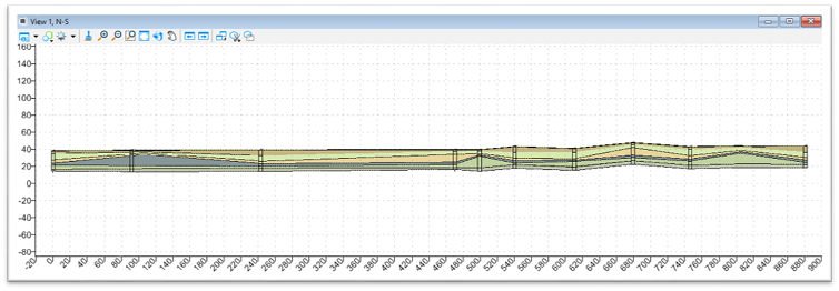
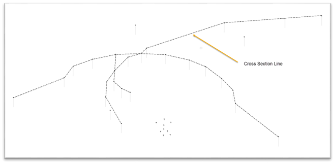
Create Cross Sections
- Create cross sections from
3D line strings
- Display boreholes and any
depth items (lithology, water level, etc.)
- Annotations
- Cut from meshes and
surfaces
- Can be used in fence
diagrams
Create Fence Diagrams
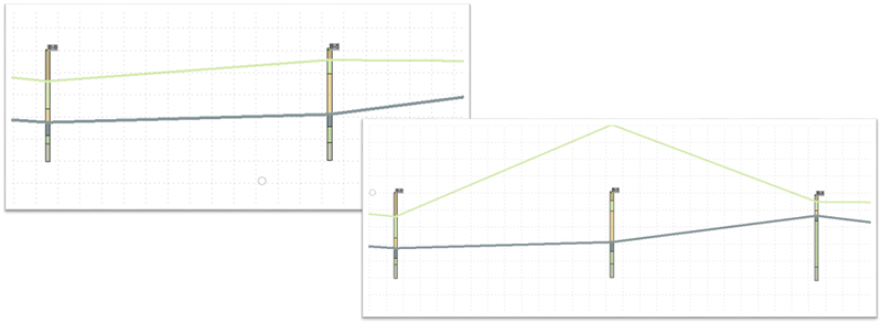
- This tool takes a cross
section model (which is a 2D model) and displays it in a 3D view
- If the original line that
was used to create the cross section is a multiline, then the cross section
will be attached in reference as many times as there are segments in the line
and clipped
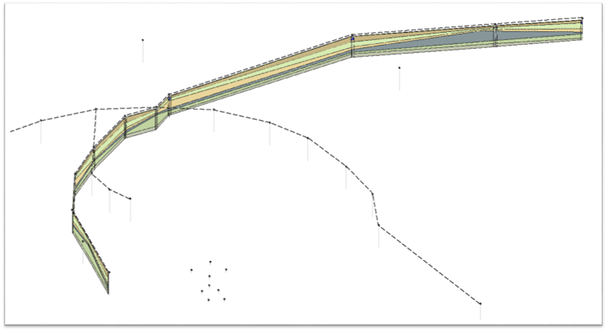
Create Fence Diagrams: 3D View
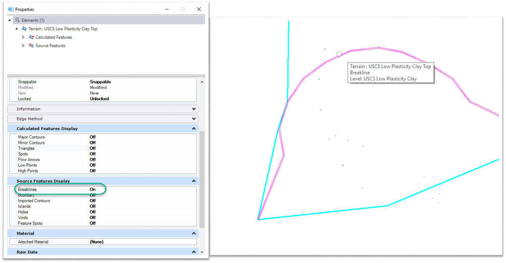
Edit Terrain from Cross Section
- When a terrain line is
edited from a cross section model, it generates a breakline in the original
terrain element
Update Terrain with Breakline
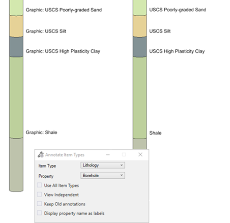
Annotation
Option To Display Property Name
- Functionality to display
property name as labels