Configuring Geospatial Datasource Settings
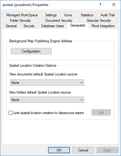
The Geospatial extension to ProjectWise Administrator adds a Geospatial tab to the Datasource Properties dialog. This tab contains the Geospatial settings that pertain to the whole datasource.
Datasource Properties Dialog > Geospatial Tab
| Setting | Description |
|---|---|
| Background Map Publishing Engine Address | Clicking the Configuration button opens the Background Map Engine Settings Dialog which lets you specify the Bentley Geo Web Publisher server name or IP address. |
| New documents default Spatial Location | Controls the default spatial location for the new documents created in ProjectWise. Possible values are: |
| New folders default Spatial Location | Controls the default spatial location for the new folders created in ProjectWise. Possible values are: |
| Limit spatial location creation to datasource extent | Use to define a range of coordinates for making a spatial location scan by defining the area covered by the datasource. This limits the extracted extent of files in the datasource. This extent is defined by clicking on the Edit button and drawing a rectangle over the background map. |
| Edit | Clicking the Edit button opens the Edit Spatial Location Creation Options Dialog which lets you specify the options for the creation of spatial location. |
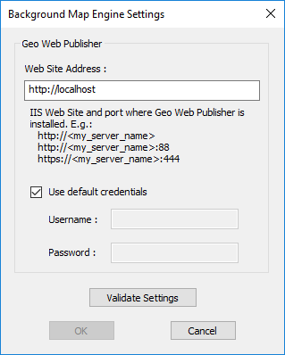
Background Map Engine Settings Dialog
Used to specify the IIS web site and port where the Bentley Geo Web Publisher server is installed.
Opens when you click the Configuration button in the Geospatial tab of the Datasource Properties dialog.
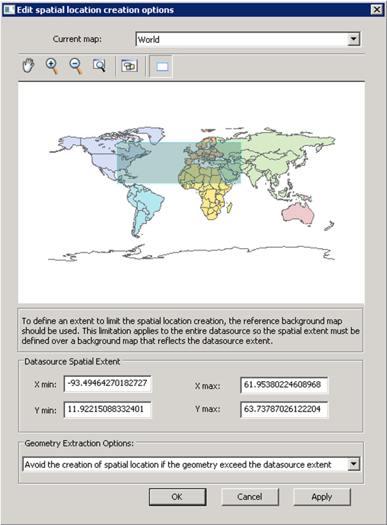
Edit Spatial Location Creation Options Dialog
Used to specify the options for the creation of spatial location.
Opens when you click the Edit button in the Geospatial tab of the Datasource Properties dialog.
| Setting | Description |
|---|---|
| Current Map |
Used to select on which Background Map the spatial extent will be drawn. The datasource spatial extent will be represented in the same coordinate systems as the selected background map. |
| Datasource Spatial Extent |
Lower left and upper right values of the rectangle that represent the area in which the spatial location can be created. The datasource spatial extent is represented in the same coordinate systems as the selected background map. |
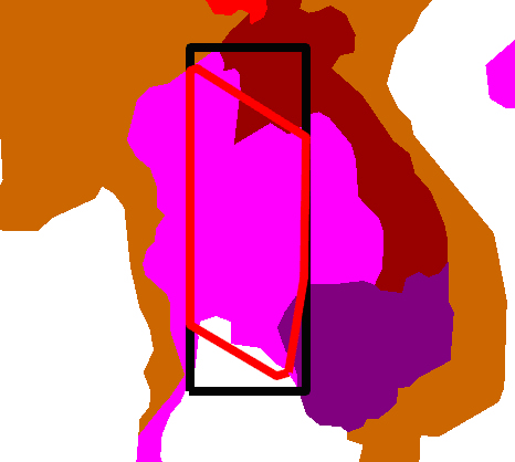
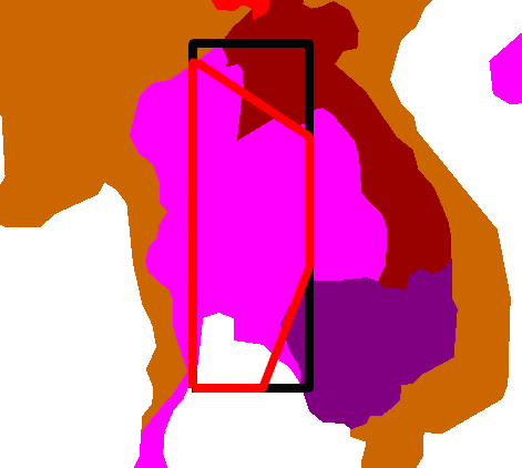
| Geometry Extraction Options |
Defines the mode for Datasource Spatial Extent. Avoid the creation of spatial location if the geometry exceeds the datasource extent (default) - Any geometry overlapping the datasource extent is considered invalid. The geometry is considered invalid because it overlaps the datasource extent. Exclude points outside datasource extent - Each point in the scanned file is validated against the datasource extent. If a point is outside the datasource extent, it is not considered when computing final geometry. Using this option may slow the extraction of a file's extent because it involves more computation. Valid geometry is restricted by the datasource extent. Clip geometry if overlapping datasource extent - Geometry is computed normally, and then the resulting geometry points are compared one by one with the datasource extent. Points outside the extent are clipped to the datasource's extent. Valid geometry is restricted by the datasource extent. |