Spatial Location Introduction
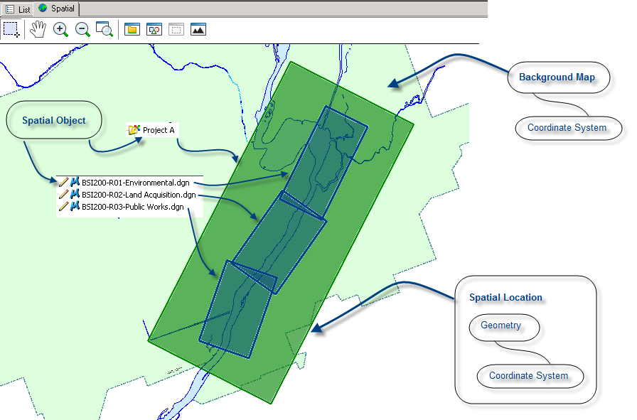
Spatial tools in ProjectWise Explorer add spatial indexing functionality to ProjectWise. Any document or folder in ProjectWise can be associated with a geographical footprint, called a spatial location, which lets you locate the associated document or a folder on a map displayed in ProjectWise Explorer. Each spatial location is a pair composed of a geometry (in this version, a polygon) and a coordinate system. The coordinate system ensures data integrity and is used by the system to re-project a spatial location on a map that does not have the same coordinate system.
The image below illustrates the relationships between spatial locations, documents, folders and the background map.
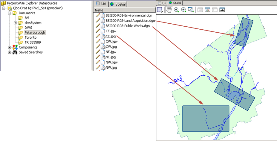
The image below illustrates this concept: documents stored in ProjectWise are associated with locations and are displayed over a background map.
Spatial tools added to ProjectWise Explorer include:
-
A Spatial tab which allows to view the selected document's spatial perspective. The Spatial tab contains the Spatial Navigator, the Navigation toolbar, and the Symbology Legend.
-
A Spatial properties tab for documents and folders that contains all the information about spatial locations.
-
A spatial criterion for the search tools. This criterion can be combined with any other criteria, and allows the creation of spatial searches.
-
A set of import and scanning tools, dedicated to the batch creation and extraction of spatial locations.