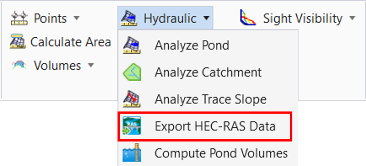
Export HEC-RAS Data
Export HEC-RAS Data is used to create cross section data that describes a river, in a format that can be read by the HEC-RAS program.
You can access this command from:
Ribbon: Terrain > Analysis > Hydraulics > Export HEC-RAS Data
There are two methods of selecting the section data:
- Use a Datapoint to select each section, within the command
- Create a Selection Set that contains all of the sections, before running the command
Using a Selection Set may be preferable if a significant number of sections need to be selected.
Prerequisites
The data required for this command is:
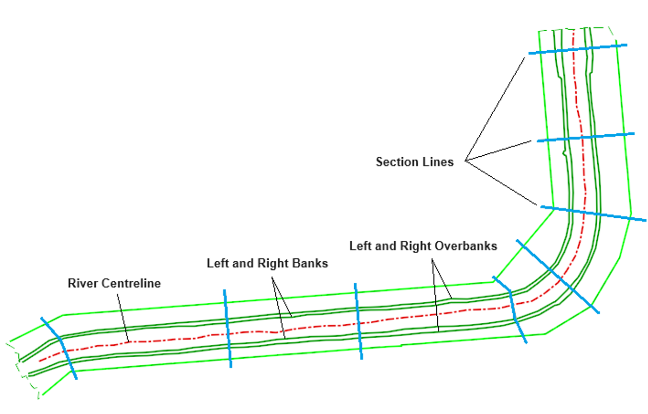
Lines that represent sections, which cover the extent of the river and surrounding land. The lines can be 2D or 3D, and they can be MicroStation graphics of Civil features. They can include changes in plan direction, so that they are perpendicular to the direction of flow. The minimum number of lines needed is 2.
A terrain model, which represents the bed of the river and the surrounding land. Its extents are usually sufficient to include the highest anticipated water level.
A river centreline, which represents the centre of the river.
Left and right banks, and left and right over banks. Four linear features, representing the bank and overbanks, on the left and right hand sides of the river centreline.
Command Prompts
This command uses graphical selections to identify the required data, so the dialog is empty.
The heads-up prompts are:
| Prompt | Description |
|---|---|
| Select First Section Line | This is the first prompt displayed if you do not have a Selection Set of section lines. Data Point to select the first section line |
| Select Next Section Line - Reset to Complete | Datapoint to select the second section line. Continue until all section lines have been selected |
| Data Point to Accept Selected Section Lines | This is the first prompt displayed if you have a Selection Set of section lines. Data Point to accept the Selection Set |
| Select Terrain Model | Data Point to select a terrain model |
| Select River Centreline | Data Point to select a linear element |
| Select Downstream End of River Centreline | Data Point near the downstream end of the River Centreline |
| Select Left Overbank | Data Point to select a linear element |
| Select Left Bank | Data Point to select a linear element |
| Select Right Bank | Data Point to select a linear element |
| Select Right Overbank | Data Point to select a linear element |
When selecting the left and right bank and overbanks, the software checks that they are to the left and right of the River Centreline. Note that left and right are in the downstream direction of the river centreline.
After selecting these elements, a Save dialog is displayed. Type a name and choose a location for the HEC-RAS Data file, then click Save.
Note that each section must cross the river centreline once, and only once. Any sections that do not do this will be excluded when the data is exported. In the case, the Message Centre will state the approximate coordinates of each section that has been excluded. If none of the sections cross the river centreline, then no data is exported.
Creating a Selection Set of Section Lines
- Use Terrain > Create > From Graphical Filter > Graphical Filter Manager to create a filter that identifies the correct graphics
- Use Geometry > General Tools > Design Elements > Select by Graphical Filter to create the Selection Set
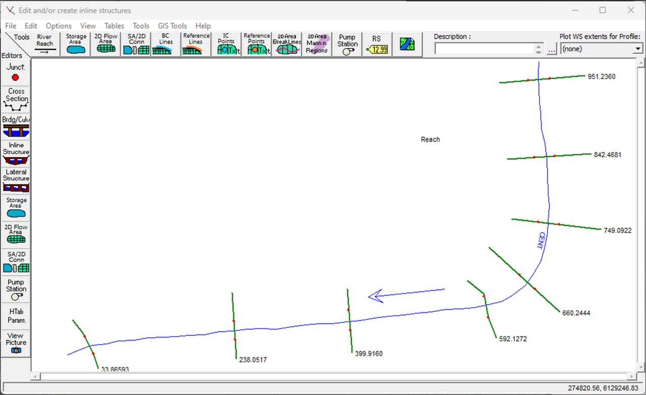
Example of data for export:
Resulting data in HEC-RAS:
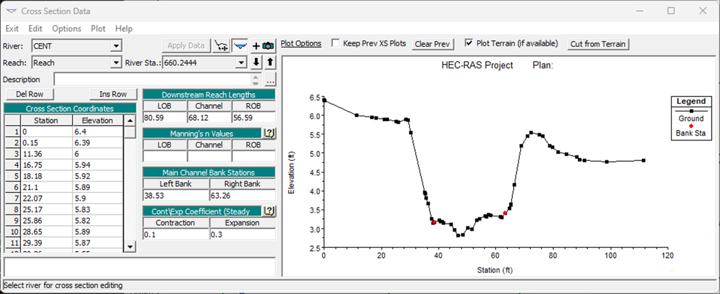
Resulting Cross Section in HEC-RAS: