Import Terrain
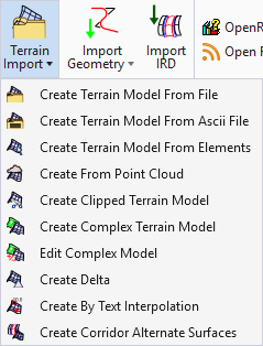
The Import Terrain tab contains tools to create a terrain model from graphical elements, ASCII files, point clouds, LandXML, and importing from various Bentley Civil products. Tools are also supported to merge together two or more models, and to clip models.
|
Setting |
Description |
|
Create a terrain model by importing from an external file. Numerous file formats are supported such as USGS DEM, DTED, Lidar (*.las), and native products (InRoads, GEOPAK, and MX). |
|
|
An automated way of storing search settings for graphic elements to automate Create Terrain Model by Elements. Uses the settings stored by Graphical Filter Manager to create the terrain. |
|
|
Create a terrain model from 3D graphical elements. |
|
|
Create a terrain model from 2D graphics which also contain an elevation label. |
|
|
Create a terrain model from 2D graphics which also contain an elevation label. |
|
|
Create a terrain model from MicroStation Point Cloud data. |
|
|
Create a terrain model by clipping an existing terrain model and providing an optional horizontal or vertical offset. |
|
|
Create a new Complex terrain model by merging/appending multiple terrain models. |
|
|
Create a new terrain model by the difference between 2 terrain models or a terrain model and a plane (elevation). |
|
|
Create a terrain model from user-specified points in a corridor model along any given path. |


