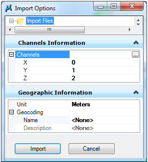
STM Import Options dialog
Used to set the configuration options for units and geographic coordinate system.
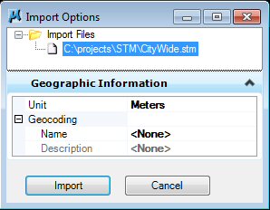
Opens when you select File > Import in the STM Elevation Sources Editor dialog.
| Setting | Description |
|---|---|
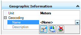
| Unit |
Specify the units for the geographic information. |
| Geocoding |
Use the drop-down menu to display a geographic coordinate system (GCS) menu. |
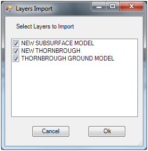
| Channels |
Binary XYZ files are a recognized format and do not need special configuration. However ASCII XYZ files need to be configured correctly to ensure proper import. After selecting an ASCII XYZ file, the Import Options dialog is displayed with the additional Channels Information section. Clicking the ellipsis ... button will open the Convert Generic Text dialog. |
| Layers |
Use to select the Terrain model(s) to import. Each node can be expanded and the Import toggle adjusted as required. You can also use the ellipsis ... button to open the Layers Import dialog for easy selection. |