OpenRoads Designer CONNECT Edition

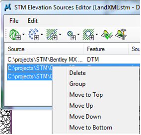
STM Elevation Sources Editor dialog

Used to add elevation data to a STM file


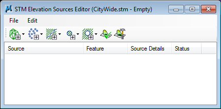
Opens when you create a new STM file.

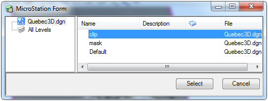
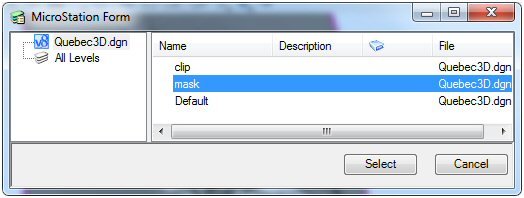
STM files can be composed of multiple sources of elevation and clip data. The order of the files in the list is important as the files are processed in order. So, if a certain area is to be clipped, then the clip definition should come after those data files. The order of the files in the Elevation Sources dialog can be changed by right-clicking on the selected files and using the contextual menu or the Edit menu items to order the files.

Files can be grouped for custom processing. For instance, when adding a portion of a new file to an existing STM, add the source file and the file that represents the clipping area into a group. That way only the source file will be clipped and not the files that are above it in the list. Files can be grouped by right-clicking on the selected files and using the contextual menu or the Edit menu items.


The supported formats described below can be used to create STM files.

SettingDescription
DTM


DTM files are elevation models that have been processed by other software

Type

File extension

InRoads

.DTM

GeoPak, GeoMacao

.TIN, .BCDTM, .DAT

Descartes Scalable Terrain Model

.STM

LandXML

.XML

DGN Level

.DGN

Elevation


Elevation files are pure XYZ points.

Type

File extension

InRoads

.DTM

GeoPak

.TIN, .BCDTM, .DAT

GeoMacao (same as GeoPak)

.TIN, .BCDTM, .DAT

STM

.STM

LandXML

.XML

DGN Level (point elements)

.DGN

Point Cloud*

.POD

ASCII XYZ

.XYZ

Binary XYZ

.XYZ

Raster DEM

Same as supported by OpenRoads Designer

*When adding a .Pod file as a "points" source to the STM, if the .Pod file is classified, only the points belonging to the "Ground" class are imported.

Breaklines


Breaklines define abrupt changes in the terrain due to ridges, escarpments, road edges etc.

Type

File extension

DGN Level (linear elements)

.DGN

Clip


Clipping polygons restricts the DTM to areas inside the polygons.

Type

File extension

DGN Level (closed shapes)

.DGN

Specify the level that contains clipping elements to be applied to the source elevation files. The levels come from the active DGN file. Select All Levels on the left or a specified level on the right side.


Mask


Masking polygons restricts the DTM to areas outside the polygons. They can be used to prevent DTM processing for unimportant areas such as lakes.

Type

File extension

DGN Level (closed shapes)

.DGN

Specify the level that contains masking elements to be applied to the source elevation files. The levels come from the active DGN file. Select All Levels on the left or a specified level on the right side.


Check if Up-to-date


Use to verify if any changes were made to the source files.

The STM system keeps a record of the files used to create each STM. The Check if Up to Date tool can be used to determine if any of the files used to create the STM are newer than the STM itself. In that way, the user can decide if the STM should be regenerated to become current.

Generate


Use to generate the STM.