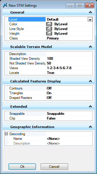
| General |
Sets symbology options for triangle display.
|
| Scalable Terrain Model |
-
Description — Description of the STM.
-
Shaded View Density — 1 – 100 adjusting the density of display when in shaded mode.
-
Not Shaded View Density — 1 – 100 adjusting the density of display when in not shaded mode.
-
Views — Views in which the STM should be displayed.
-
Locate — Enables locate of the STM.
|
| Calculated Features Display |
Turns on and off various display modes for the STM.
-
Contours — Displays the STM as contours.
-
Triangles — Displays the STM as triangles.
-
Draped Rasters (3D only) — Displays rasters draped on STM.
|
| Extended |
Displays additional options.
|
| Geographic Information |
Sets the geographic coordinate system (GCS).
|