Parcel Area Default Properties

Select the Explorer icon from the Primary tool group of the ribbon menu.
From the Explorer dialog, select Standards>[Current DGN file name]>Site Layout Settings>Site_Defaults>Parceling Area Default Properties>Area. Next, right-click and select Properties.
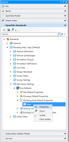
In the Properties dialog, the settings are displayed and can be edited.
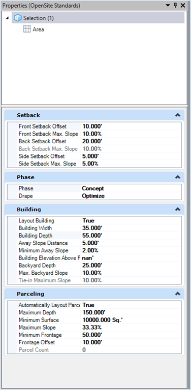
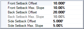
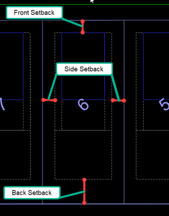
Setback Settings
The Parcel Setback Settings control the two-dimensional layout associated the positioning of the design elements common to each parcel.
Setback/Slope Front: The minimum distance that structures can be positioned from the front of a parcel and maximum slope for that area.
Setback/Slope Back: The minimum distance that structures can be positioned from the back of a parcel and maximum slope for that area.
Setback/Slope Sides: The minimum distance from the parcel side which structures can be positioned and maximum slope for that area. This is the same for both sides of the parcel. If need different values per side, this can be done in the preliminary phase.
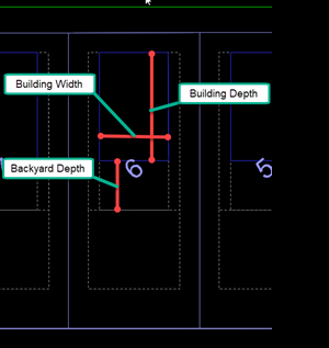
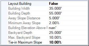
Building Settings
The Building Layout Settings control the two-dimensional design of the building, grading around building and backyard depth/slope associated with each parcel.
Building Width: The width of the building pad measured along the width of the parcel.
Building Depth: The depth of the building pad measured along the depth of a parcel.
Away Slope Distance: Distance grading should slope down and away from building.
Minimum Away Slope: Minimum slope of grading away from building.
Building Elevation Above Road: Vertical distance FFE of the building should be above road.
Backyard Depth/Slope: The Backyard is the section between the end of the Building Away Slope and the Tie-in, measured along the centerline of the parcel.
Tie-in Maximum Slope: The Tie-in is the section from the Backyard, or end of the Building Away Slope if there isn't a Backyard, to the back of the parcel, measured along the centerline of the parcel.
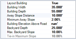
Layout Building: Specifies if parcels are drawn with or without building pads.
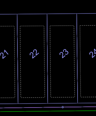
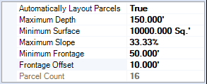
Parceling
The Parcel Settings control the two-dimensional layout associated with each parcel.
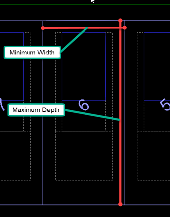
Maximum Depth: The maximum depth of the parcel.
Minimum Surface: The minimum surface area for each parcel.
Minimum Frontage: The minimum width of a parcel measured at a specific distance (Frontage Offset) from the front of a parcel. Note: For Parcels along curves, the width is measured along the resulting chord.
Frontage Offset: The distance from the front of a parcel at which the Min Parcel Frontage (parcel width) is measured.