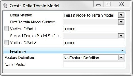
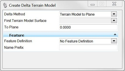
Create Delta
 Used to create a delta TM between a surface and plane or between two surfaces, which can then be used for Isopach contouring.
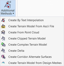
You can access this tool from the following:
The Delta Surface tool creates a delta TM between a surface and plane or between two surfaces, which can then be used for Isopach contouring. The Z value in the delta TM is the difference between the two specified models or model and surface, rather than actual elevations. Any voids in any of the terrain models produces a corresponding void in the delta model (as the software cannot compute the difference in these areas).
Note: It is prudent to use a Feature Definition unique from the original TM, so each can be distinguished, as the delta TM is on top of the original TM when reviewing in a Top View.
|
Settings |
Description |
|
Delta Method |
Terrain Model to Terrain Model: specify two files. Terrain Model to Plane: specify one file and an elevation. |
|
Vertical Offset 1 |
Vertical Offset 1 moves the first terrain model up (positive value) or down (negative value) by the offset distance, in terms of master units prior to processing the delta command. |
|
Vertical Offset 2 |
Vertical Offset 2 moves the second terrain model up (positive value) or down (negative value) by the offset distance, in terms of master units prior to processing the delta command. |
|
To Plane |
elevation of the plane specified in terms of master units (feet or meters). |
Workflow
|
Prompt |
User Action |
|
Select the Delta Method. |
Graphically select the TM. |
|
Locate first terrain model. |
Graphically select the TM. |
|
Locate second terrain model or Enter Plane. |
Graphically select the TM or enter elevation (in master units). |
See also