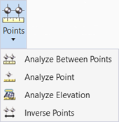
Analyze Elevation
 Creates a Terrain Check Report
that compares elements to a terrain.
You can access this tool from the following:
Ribbon: Terrain > Analysis > Points split button
Ribbon: Survey > Terrain > Analysis > Points split button
Workflow
- Open a DGN.
- Select Terrain > Analysis > Analyze Elevation.
- Use the checkbox to Enter a Tolerance Value. Left click to accept.
- Select Terrain and select
survey lines and points.
Datapoint to display the Terrain Check Report in the Report Browser. It contains Element Name, Feature Definition, Element Type, Tolerance, etcetera.
|
Setting |
Description |
|
X |
Reports the X coordinate of the reference point. |
|
Y |
Reports the Y coordinate of the reference point. |
|
Length |
Reports the length of the line between points. |
|
CheckElevation |
Reports the elevation of the point. |
|
TerrrainElevation |
Reports the elevation (in master units) of the user-selected point. |
|
ElevationDifference |
Reports TerrainElevation minus the CheckElevation. |
|
Tolerance |
Within or Outside |

