Defining a Join
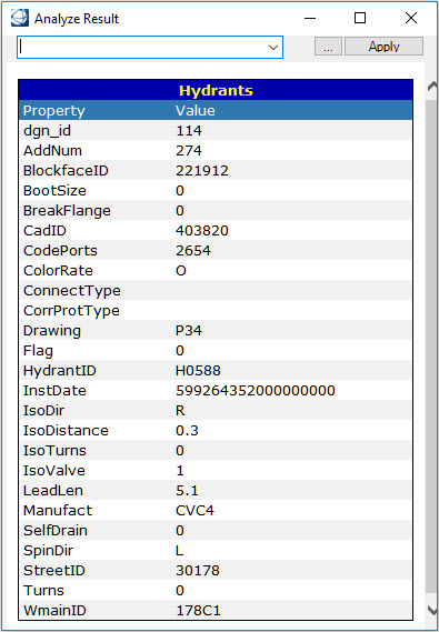
In the following example, Hydrants and Watermains both have a WmainID property which will be used to create the join.
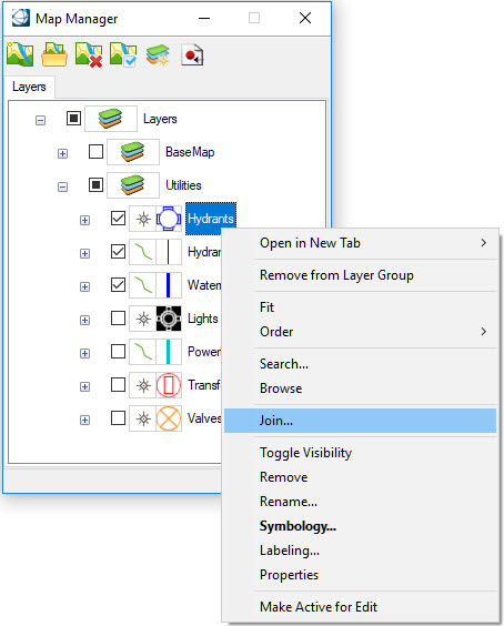
Select the feature on which the join is to be created and select Join from the context menu.
MAP JOIN SHOW
The Join interface lists all the features available in the session. The left side will be set to the feature selected from the Map Manager. A different feature can be selected by using the pulldown list.
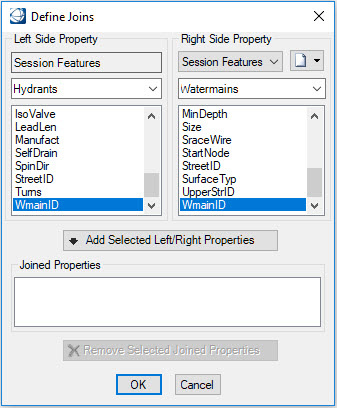
On the right is a similar list of features, currently known to the Bentley Map session. To create a join, select a property from a feature on either side and select Add Selected Left/Right Properties. To create a join, the data types of both selected properties must be identical.
To remove the join, select Remove Selected Joined Properties.

Only features that can be valid Bentley Map feature types are supported. This includes all supported GIS types and Oracle Spatial tables. Data sources such as CSV files can be defined as VRT files and loaded in the Joins dialog.
Database tables must have a primary key to be listed for the Join operation. In the case of views without primary keys, one can be defined using the following statement
Oracle: alter view cola_view add primary key (mslink) disable;
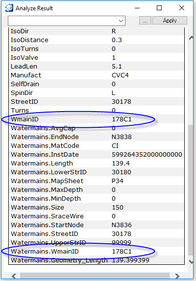
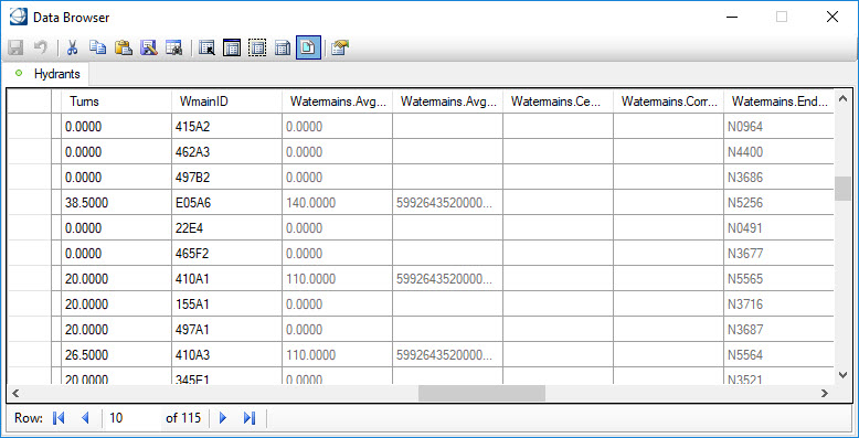
Once the join has been created, the properties from the joined feature (right side feature) will be displayed whenever the properties from the selected feature (left side feature) are accessed. If there is more than one feature that meets the criteria, as in a one to many relationship, then only the first queried feature properties will be displayed.