To Specify an XML Format File
Some users want to be able to specify an XML formatted file as input for the domain list. This procedure specifies a domain list to be added but will replace the XML file normally created by OpenCities Geospatial Administrator with one provided by you.
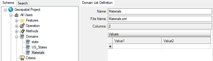
- Create a domain entry just as you normally would, but do not add any entries.
-
Create your XML file using a format as shown below.
<?xml version="1.0" encoding="utf-16"?> <DomainListDef name="Materials" numColumns="2" genFile="materials.xml"> <domainRow col1="CAST IRON" col2="CI" /> <domainRow col1="POLY VINYL CHLORIDE" col2="PVC" /> <domainRow col1="CHROMED BRASS" col2="CB" /> <domainRow col1="CHROMED COPPER" col2="CC" /> <domainRow col1="GALVANIZED IRON" col2="GI" /> <domainRow col1="COPPER" col2="C" /> <domainRow col1="CHLORINATED POLY VINYL CHLORIDE" col2="CPVC" /> <domainRow col1="CROSS LINKED POLYETHYLENE" col2="PEX" /> <domainRow col1="BLACK IRON" col2="BI" /> </DomainListDef> - In the Files section of your workspace, add a file category (name is not important).
- Select the newly created file category, then select and then select the XML file, change the destination directory to xml\domains as shown.
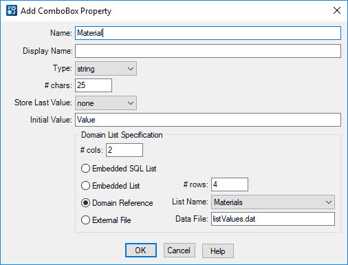
- For the feature property, select the domain reference just as you would normally for a named domain list, being sure to update the # cols accordingly.
- Export and run workspace.