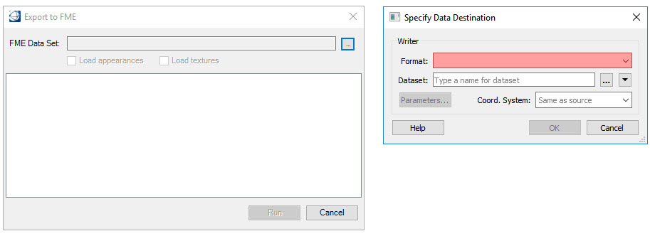
To export from the open design file using FME, select File >
Export > Geospatial File Types > FME Export. The Export to FME dialog
opens.
Click the select button to open the Specify Data Destination
dialog.
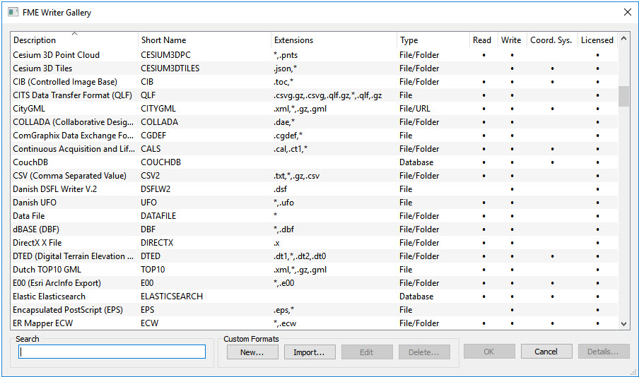
In the Specify Data Destination dialog, select the format for the
data to be exported. Selecting the down arrow will display a list of default
formats. Selecting More Formats will launch the FME Writer Gallery. Scroll
through the list and make a selection. Click OK.
In the Specify Data Destination dialog, specify the name of the
output dataset.
Use the Parameters button to change settings applicable to the
selected format. Click OK. The types of datasets and how to use them are
explained in the Datasets section.
The coordinate system is typically the same as the design file. To
select a different coordinate system, choose the arrow button and select a
coordinate system from the Coordinate System Gallery.
The Export dialog will be populated with features and properties
found in the design file. Select which features and properties to export and
edit the Mapped name if desired.
Click Run to start the export process. After the export is
complete select Done to close the dialog.