Command Line Option
When registering Oracle spatial features, you can include the database owner table to the display name of the feature. This is accomplished by adding the following command line option :
-register_fullname
The command line option is provided for backward compatibility with previous versions.
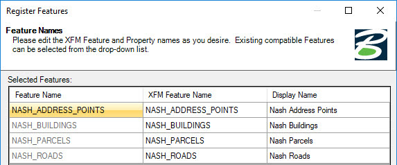
With the command line option, the features are registered as shown. Notice the addition of NASH prepending the feature name.
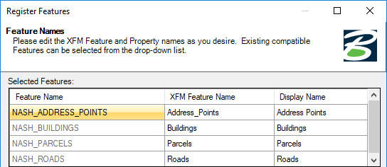
Without the command line option, the registered features are as follows: