Create Buffer
The Create Buffer tool creates a new feature instance at a specified distance around another feature. Buffers can be generated for all feature instances, only those within a specified spatial extent, or those that meet certain criteria.
The Create Buffer tool is selected from the feature's right click menu in the Map Manager.
When working in a 2D model, the buffer options are as noted:
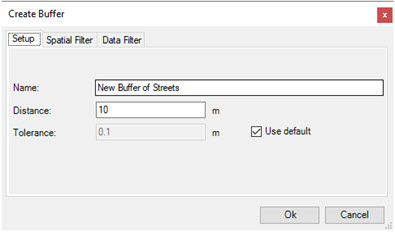
The Setup tab in provides the following options:
| Option | Description |
|---|---|
| Name | Specifies the name to be used for the new feature layer created by the buffer tool. |
| Distance | Defines the distance from the individual features to the generated buffer in master units. |
| Tolerance | Specifies the tolerance. Lower values produce more vertices in the resulting buffer feature, higher values produces fewer vertices in the resulting buffer feature. |
When working in a 3D model, the buffer tool is available for polygon features. The resulting geometry are polygon collections enclosing a volume with a height specified by the Height option.
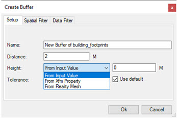
The Setup tab provides the following options:
In both 2D and 3D models, the Spatial Filter tab provides options to specify which feature instances to buffer:
| Option | Description |
|---|---|
| None | No spatial filter will be used and all feature instances will be buffered. |
| Fence | Only the feature instances within a fence are buffered. |
| Selection Set | Only the selected feature instances are buffered. If a selection set is active , it will be automatically selected. The Data Browser can also be used to select features for buffering by sorting and filtering and then using the Add to Selection Set tool. |
| View | Only the feature instances located in the view are buffered. |
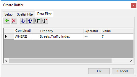
In both 2D and 3D models, the Data Filter tab provides options to specify which feature instances to buffer:
When the parameters have been defined, click OK to start the buffering process.
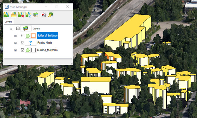
The buffer tool creates a new feature class in the Map Manager using the name specified in the Setup tab. The resulting elements are placed on the active level using the active symbology. These new elements can be edited as required using the element manipulation tools. The symbology can be adjusted using the Map Manager.