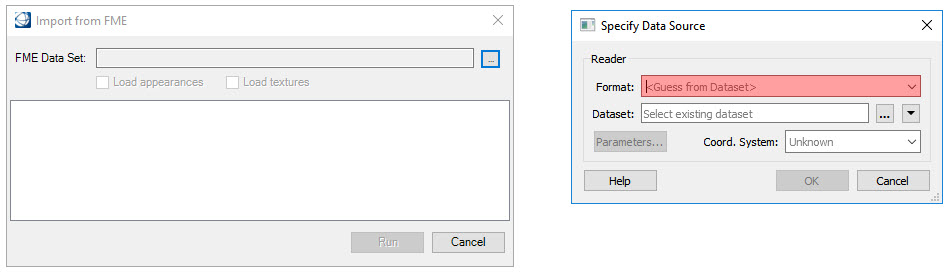
To import from FME into your open design file, select File > Import > Geospatial File Types > FME Import. The Import from FME dialog opens.
Click the select button to open the Specify Data Source dialog.
(Optional) In the Specify Data Source dialog, select the data format to be imported. If this option is not defined, FME will attempt to guess the data format from the selected dataset. Selecting the down arrow will display a list of recently used formats. Selecting More Formats will launch the FME Reader Gallery. Scroll through the list and make a selection. Click OK.
Select the dataset to be imported. If Step 3 above was not completed, the Format field will automatically display the geospatial format of the selected dataset. The types of datasets and how to use them are explained in the Datasets section
Use the Parameters button to change settings applicable to the selected format. Click OK.
The coordinate system is typically read from the incoming dataset. If the coordinate system is unknown, choose the arrow button and select a coordinate system from the Coordinate System Gallery.
The Import from FME dialog will be populated with features found in the dataset. You can select which features to import and edit the Mapped Name if desired.
Click Run button to start the import process. After the import is complete select Done. Refresh or fit the view to see the result.