Working with ArcGIS Feature Server
OpenCities Geospatial Administrator and OpenCities Map Ultimate support querying and updating feature data published using ArcGIS Server features services. Read/Write access to features services may be accessed from the Map Connections dialog as one of the following:
- An ad hoc connection
- A saved ArcGISx connection file
- A named connection with a defined graphical source. Graphical sources are defined in a geospatial project using OpenCities Geospatial Administrator
Read-only access is available from the Imports tab of the Map Imports/Exports dialog.
ArcGIS services may be arranged in hierarchy of folders, and each feature service may have any number of layers. While the schema of an entire server can be discovered, the scope of schema discovery may be constrained by specifying the URL of a folder or service. All layers within a service will be discovered.
Connections to ArcGIS server are made via the REST API and are specified using a URL. A user name and password are optional. To determine the URL, direct a web browser to the root REST API URL of the ArcGIS Server. For example https://<server>:<port>/arcgis/rest/.../. Then navigate to the desired folder or individual feature service.
For example, the root URL https://sampleserver6.arcgisonline.com/arcgis/rest/ can be expanded to the following: https://sampleserver6.arcgisonline.com/arcgis/rest/services/Energy/Geology/FeatureServer
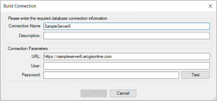
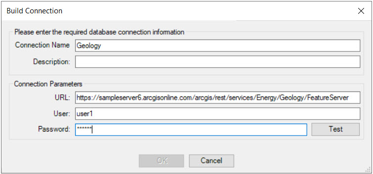
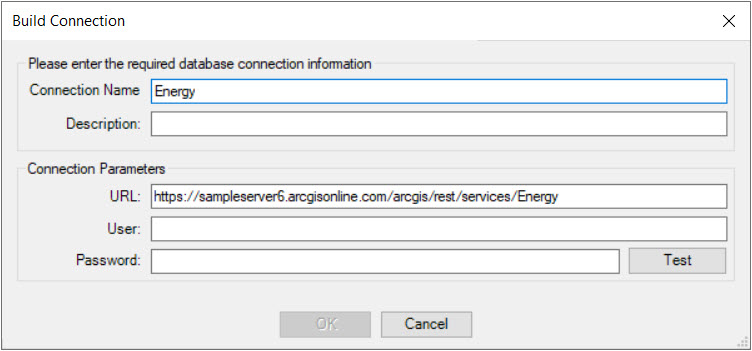
The following examples illustrate the Build Connection dialog when registering feature services in OpenCities Geospatial Administrator:
Single feature service with a user name and password:
Folder without a user:
Server without a user