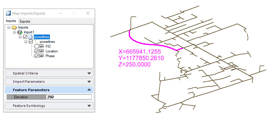
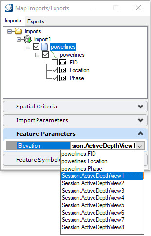
Specifying a Numeric Value for Elevation
The Feature Parameters pane provides an Elevation field for importing geospatial data to a specific elevation. When a value is entered in this field, all data from the geospatial file will be placed on the elevation specified. To use the Active Depth of the view, choose the appropriate Session.ActiveDepthView option. If the Elevation field is left blank, the features will be placed at an elevation of zero regardless of your Active Depth setting.