| Attach |
If yes, the file is saved and attached to the current design file after the conversion. If no, the file is saved on disk, but not attached. |
| Multiple Output |
(Only available if multiple files are selected) If yes, multiple files are created on output (one for each input file). If no (the default), all input files are used to create a single output file. |
| Import RGB |
If yes, the RGB values are imported. |
| Import Intensities |
If yes, the intensity values are imported. |
| Geometry Unit |
Specifies the geometry unit of the converted file(s). |
| Normalize Intensities |
If yes, the intensity values are normalized by analyzing distribution. |
| Compression |
Sets the maximum allowable loss of accuracy in meters during compression. A higher number means more compression. Options are:
- Automatic
- Terrestrial Scan Data 0.001 (1mm)
- Aerial LIDAR data 0.050 (50mm)
- Mobile Mapping data 0.0075 (7.5mm)
|
| Spatial filtering |
Enables or disables spatial filtering. Effects the disabling or enabling of the Spatial Spacing option. |
| Spatial Spacing |
(Only available if Spatial Filtering is enabled) The Spatial Spacing value specifies the size of the 3D cube to use for filtering. Only a single point per cubed area will be imported. This option is designed to achieve a more even density. For example, there is often a greater density of points closer to the scanner that is not required. |
| RGB Unit |
Specifies if the RGB values are defined on bytes from 0 to 255 or with floating point values between 0 and 1.
- 0 to 255 (byte)
- 0.0 to 1.0 (floating point)
|
| Intensity Unit |
Specifies the unit for the intensity values.
- 0 to 255 (byte)
- 0.0 to 1.0 (floating point)
|
| Import Normals |
If yes, include surface normals if available in source format. |
| Generate Normals |
If yes, generate surface normals if this feature is available in input format. |
| Data Source |
Riegl RSP’s definition of which data source to use for points and color.
|
| Intensity Source |
Riegl RSP’s definition of which type of intensity to include.
|
| Reflection Scale |
Riegl RSP’s pre-scalar for reflectance values. |
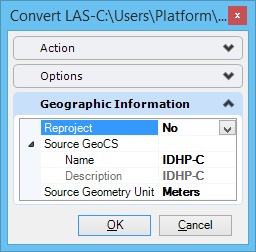
| Reproject |
Select whether or not to reproject the point cloud. If Yes, the Destination GeoCS is written into the point cloud. If No, the Source GeoCS is used. |
| Source GeoCS |
Select a GeoCS to use if the point cloud is not being reprojected. |
| Destination GeoCS |
The GeoCS that will be written to the point cloud when it is reprojected. |