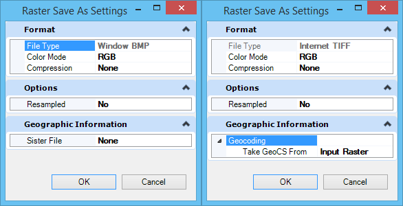
Raster Save As Settings Dialog
Used to set options for saving a raster file in a different format. Items that appear in this dialog depend on the format chosen for the file.
| Setting | Description |
|---|---|
| Format | File Type — Lets you select the file format for the output file(s), from an option menu containing the file formats supported. Color Mode — Lets you select the color mode from an option menu containing the supported color modes for the selected file type. Compression — Lets you set the compression type from an option menu containing the supported compression types for the selected file type and color mode. Tiled — Lets you set this option when exporting a raster to a format that supports tiles. |
| Options | Resampled — If ON, the converted file(s) are resampled. That is, any rotation, or affinity is removed from the transformation matrixes. Background — If Resampled is ON, use to select the color to be used to fill the section without data in the newly created raster. Reproject — If Resampled is ON, indicates that the raster must be resampled from its geocoordinate system to the specified geocoordinate system. Note that this field will not be visible if the GCoord database and Bentley Descartes are not loaded. Number of colors — If exporting a raster to a format that is in "256 Colors" Color Mode, lets you specify the number of colors. |
| Geographic Information | Geocoding — Lets you define which geocoordinate information to use. Choose from: "Input Raster", "Current Model", or "Specified". Sister File — This option becomes available when exporting a raster to a non-georeferenced format. If you select "Specified", two additional fields become available to let you select the Name and view the Description of the available geocoordinate systems. |