MicroStation PowerDraft CONNECT Edition Help

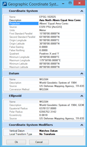
Geographic Coordinate System Properties Dialog

Used to display the properties of a geographic coordinate system (GCS). Also, can be used to:
  • change the Description of the GCS.
  • change the vertical datum for a GCS whose datum is NAD27, NAD83, HPGN, or their equivalent.
You can access this dialog from the following:
  • Geographic Coordinate System dialog: select the Details icon


SettingDescription
Coordinate System Displays the coordinate system information.
Datum Displays the datum information for the GCS.
Ellipsoid Displays the ellipsoid information for the GCS.
Coordinate System Modifiers Displays the vertical datum and local transform type information for the GCS.