To Define a Custom Datum that Allows Specifying a Grid Shift File
- Set the configuration variable MS_GEOCOORDINATE_USERLIBRARIES to point to the location of your custom .dty file.
-
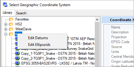
Open the
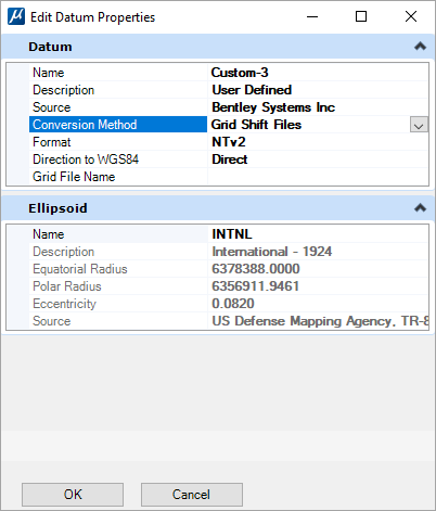
Edit Datums dialog
(right-click on a user library in the Select Geographic Coordinate
System dialog).
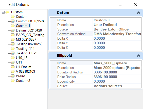
- Select New to define a new user-defined datum based on a grid shift file.
- Specify Name, Description, and Source as needed.
-
Select
Grid Shift Files in the
Conversion Method.
The properties will default to NTv2, Direct, and an empty filename.
-
Set the properties and assign a file name.
The file name is specified as a directory relative to the root GeoCoordinateData directory of the product. For example, C:\Program Files\Bentley\MicroStation <product_version>\MicroStation\GeoCoordinateData. Either forward or backward slashes can be used. They will be converted as necessary.
-
Click
Ok.
The file will be defined.
-
Click
Done.
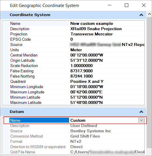
You can edit a new GCS using the Edit Geographic Coordinate System dialog.
-
In the
Select Geographic Coordinate System
dialog
(),
right-click on the geographic coordinate system where you wish to use the
custom defined datum and select
Edit Coordinate System Properties.
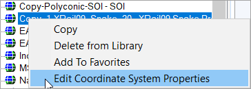
The Edit Geographic Coordinate System dialog opens.
- In the Datum section from the Name drop-down select the newly defined datum.
-
Click
OK.
Datum properties will be updated for the selected GCS.
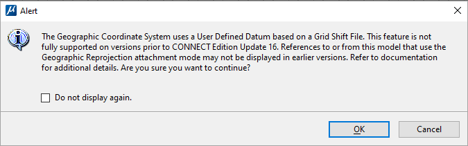
If you select a user-defined GCS based on a user-defined
datum that uses Grid Shift File to assign to a DGN model, you will see the
below alert:
The Grid file must be installed in the default directory,
C:\Program Files\Bentley\MicroStation
<product_version>\MicroStation\GeoCoordinateData.