(Technology Preview) Populate an Item Type with Latitude/Longitude Properties
Allows you to use an Item Type Expression to extract the Latitude/ Longitude coordinates of an element, so that it can be used, for example, to create smart annotations with Text Fields.
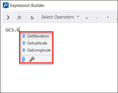
Define an Item Type property by typing one of the GCS
Expressions here below either in the Expression filed or using Expression
Builder.
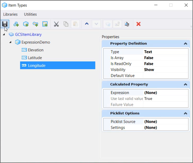
- 1. Create three Item Types properties named Elevation, Latitude and Longitude in the Item Types Dialog.
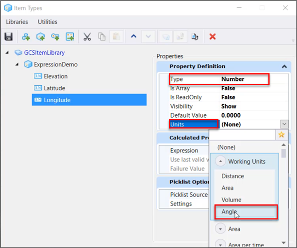
- In the Properties Definition, Select the Property Type as Number followed by selecting the Units as Angle and Save it.
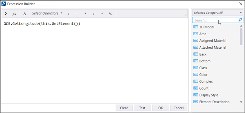
- In the Calculated Property section, click on the three dots in the Expression field. The Expression Builder dialog opens. Enter the expression as shown below:
- Click on Test.
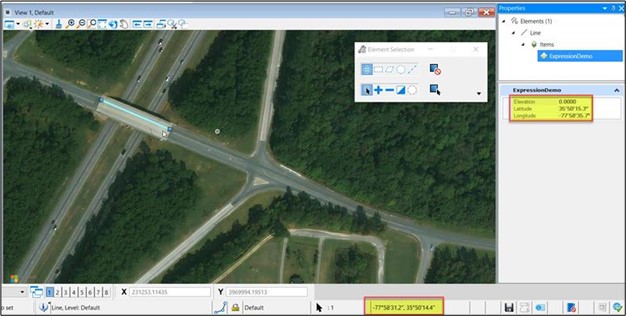
- Click OK and save the changes in the Item Type dialog. The Item Type is defined and attached to an element
- Select the element attached to the Item Type and view its properties in the property pane which is driven from GCS expression defined above.
- The Latitude/ Longitude Co-ordinates are displayed in the Properties pane.