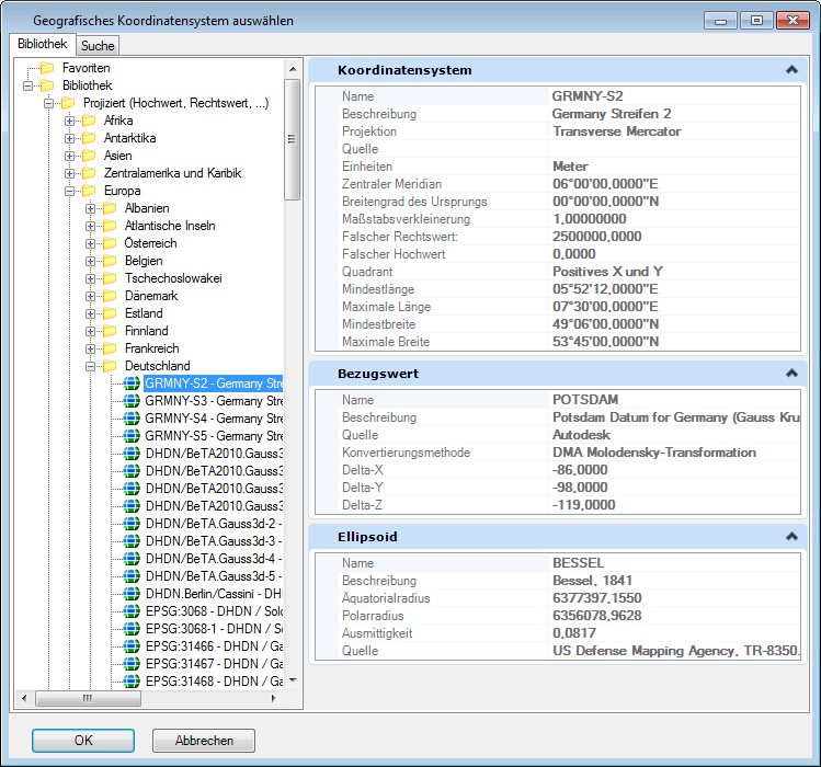
Select Geographic Coordinate System Dialog, Library Tab
Contains controls for selecting a geographic coordinate system (GCS) from a tree showing groups of geographic coordinate systems.
| Einstellung | Beschreibung |
|---|---|
| Favorites | Contains the geographic coordinate systems you or an administrator set aside for quick access. You can add and remove geographic coordinate systems from the Favorites folder. |
| Library |
Categorizes geographic coordinate systems into two groups: Geographic (which uses latitude and longitude coordinates) and Projected. The GCSs are further divided into subgroups by geography. The properties of the selected GCS are displayed as read-only in the right pane. These properties are the same as those in the Geographic Coordinate System Properties dialog.
You can also use the user-defined GCSs that contain user-defined Datums and Ellipsoids. A design file with a GCS that contains user-defined ellipsoids or datums can be opened successfully without access to the GCS library that contains the GCS. The only limitation is that the value of certain ellipsoid and/or datum parameters (for example the Source) requires access to the library. Thus, when the library is unavailable, their values will be blank in the Geographic Coordinate System Properties dialog. However, this does not cause any operational problems. Bemerkung: MicroStation V8i (SELECTseries 2) and earlier versions will not recognize the GCS with a user-defined ellipsoid or datum in a model. If you open a model with such a GCS in an earlier version, it will say that no Geographic Coordinate System is attached. Any geographically reprojected or transformed reference attachment for which the GCS of either the master file or the reference attachment uses such a GCS will not display. Such a reference will show up red in the References dialog, and when you pause the pointer over any of the fields except the file name field, a balloon text will say Unable to perform required Geocoordinate Transformations.
|