Longitude and Latitude Readout
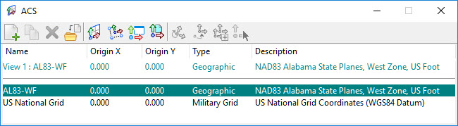
When a geographic coordinate system is assigned to a model, it appears in the Auxiliary Coordinates dialog. When it is designated as the active auxiliary coordinate system, data can be entered in longitude, latitude format, and coordinate readout can be set to show longitude and latitude.
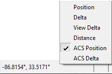
To get a longitude, latitude coordinate readout, key in SET TPMODE ACSLOCATE, and turn on Running Coordinates by right-clicking the status bar. Click on the coordinates and select ACS Position. When a tentative point is entered, the tentative point readout also shows longitude, latitude.
The mode, precision, and format of the longitude and latitude values are controlled in the Design File Setting dialog under Angle Readout and Working Units.
Data points can be entered in longitude, latitude by setting the active ACS to the geographic coordinate system and using the POINT ACSABSOLUTE key-in with the longitude and latitude entered in any of the following formats:
- 12.345 = 12.345 degrees
- 12^34.5 = 12 degrees, 34.5 minutes
- 12:34.5 = 12 degrees, 34.5 minutes
- 12d34.5 = 12 degrees, 34.5 minutes
- 12d34.5m = 12 degrees, 34.5 minutes
- 12:34’56.7 = 12 degrees, 34 minutes, 56 seconds
- 12:34’56.7 = 12 degrees, 34 minutes, 56 seconds
- 12:34:56.7 = 12 degrees, 34 minutes, 56.7 seconds
- 12d34m56.7 = 12 degrees, 34 minutes, 56.7 seconds
- 12d34m56.7s = 12 degrees, 34 minutes, 56.7 seconds
Negative values for longitude indicate western hemisphere, and negative values for latitude indicate the southern hemisphere.