To Select a GCS
-
Select
.

The Geographic Coordinate System dialog opens and displays the attributes of a GCS if one has been assigned to the active model.
-
Select the appropriate placement tool for your GCS and enter your settings in the corresponding dialog.
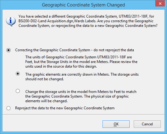
If the active model already has a GCS, the Geographic Coordinate System Changed dialog opens.
- Select the appropriate option for your data. You can choose to correct the geographic coordinate system which will not change your data, or you can reproject your data which will change the data in your file.
- (Optional) If you selected the "do not reproject" option and if the units of the GCS differ from the storage units in the model, you must also choose whether or not to change the storage units.
- Do one of the following: