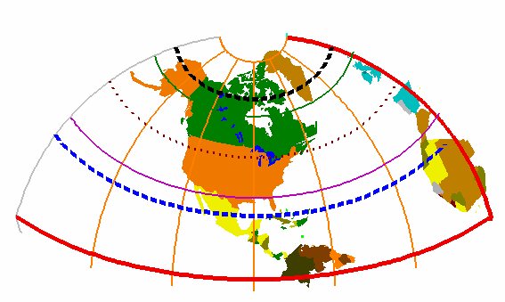
Azimuthal Equidistant
Not equal-area or conformal, it is another projection which has been in use for thousands of years. Presently, it is usually seen on insets of maps of the world showing the polar regions and hemispheres. In 1569, Mercator was one of the first to use it in this manner on his world maps when he demonstrated his now famous cylindrical projection. Maps which show the entire sphere are possible when using this projection although the distortion is extreme.
Aviators use Azimuthal Equidistant for their chart work, and it is especially useful for anyone wanting to track wave movement away from a central point. This is due to a unique quality of the Azimuthal Equidistant projection: distances radiating along straight lines from the center are true to linear scale. The position of any place along the line can be shown as a relative distance from the center.
Two variations of this projection are handled. In the first variation, the orientation of the positive Y axis is defined by a latitude and longitude of a point on the positive Y axis. In the second form, the azimuth of the Y axis is defined by an actual angle, east of north, of the Y axis. The specific variation to be used is indicated by the form variable. If an invalid form is provided, a coordinate system where the Y axis is true north is generated.