Analysis options for Underground Maps
There are certain options you can set when using Underground-specialised maps. You can instruct the software to add specialised Underground map tracks to the Analysis Timeline; you can set absolute or relative 15 and 60-minute intervals; you can set default map sizes and also set default image formats for Snapshot events.
To set Analysis options:
- Select .
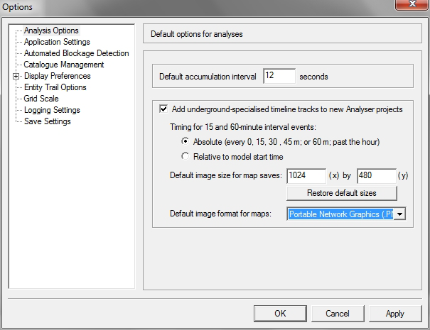
- Check the box labelled 'Add underground-specialised timeline tracks to new Analysis projects'. This ensures that all projects have relevant Underground Map tracks on the Analysis Timeline.
- For the option 'Timing for 15-minute interval events', select one of the two options:
-
Select a 'Default image size for map saves': it is probably best
to keep the default values of 1024 x 480 but you can enter your preferred
dimensions in pixels.
If you change these dimensions but later wish to restore the original dimensions, click the Restore default sizes button.
- Select a 'Default image format for maps' from the drop-down list ( 'png', 'bmp' or 'jpg').
- Click Apply to save your settings, or click OK to save your settings and close the dialog.