Select Coordinate System Dialog
Used to select the Coordinate System when creating a new WCS definition file.
Opens when you click the selection button of the Coordinate System item in the WCS Coverage Editor dialog - Selected Coverage Definition tab.
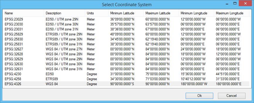
| Setting | Description |
|---|---|
| Name |
Name of the coordinate system. |
| Description |
Description of the coordinate system. |
| Units |
Displays the coordinate system units (meters or degrees). |
| Minimum/Maximum Latitude |
Displays minimum and maximum latitude values of the coordinate system. |
| Minimum/Maximum Longitude |
Displays minimum and maximum longitude values of the coordinate system.. |