Scalable Mesh Elevation Source Editor dialog
Used to add elevation and imagery data to a 3SM file.
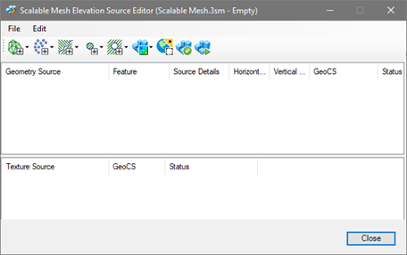
Opens when you create a new 3SM file.
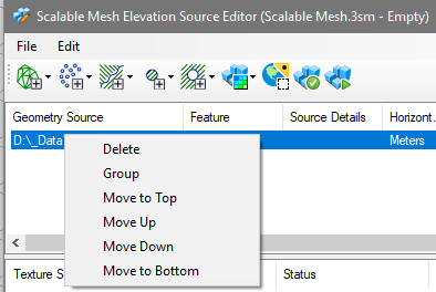
3SM files can be composed of multiple sources of elevation and clip data. The order of the files in the list is important as the files are processed in order. So, if a certain area is to be clipped, then the clip definition should come after those data files. The order of the files in the Elevation Sources dialog can be changed by right-clicking on the selected files and using the contextual menu or the Edit menu items to order the files.
Files can be grouped for custom processing. For instance, when adding a portion of a new file to an existing 3SM, add the source file and the file that represents the clipping area into a group. That way only the source file will be clipped and not the files that are above it in the list. Files can be grouped by right-clicking on the selected files and using the contextual menu or the Edit menu items.
The supported formats described can be used to create 3SM files.
| Type | Description |
|
Terrain |
|
|
Point |
Point files are pure XYZ points.
*When adding a .Pod file as a "points" source to the 3SM, if the .Pod file is classified, only the points belonging to the "Ground" class are imported. Data in the file should be from aerial sources. |
|
Breaklines |
|
|
Clip |
Clipping polygons restricts the DTM to areas
inside the polygons.
Specify the level that contains clipping elements to be applied to the source elevation files. The levels come from the active DGN file. Select All Levels on the left or a specified level on the right side. |
|
Mask |
Masking polygons restricts the DTM to areas
outside the polygons. They can be used to prevent DTM processing for
unimportant areas such as lakes.
Specify the level that contains masking elements to be applied to the source elevation files. The levels come from the active DGN file. Select All Levels on the left or a specified level on the right side. |
|
Textures |
|
|
GeoCoordination Service Download |
Geospatial query to find data sources indexed in GeoCoordination Service. Automatically download sources and generate a new Terrain Scalable Mesh. |
|
Check if Up-to-date |
Use to verify if any changes were made to the source files. The 3SM system keeps a record of the files used to create each 3SM . The Check if Up to Date tool can be used to determine if any files used to create the 3SM are newer than the 3SM itself. In that way, the user can decide if the 3SM should be regenerated to become current. |
|
Generate |
Use to generate the 3SM. |