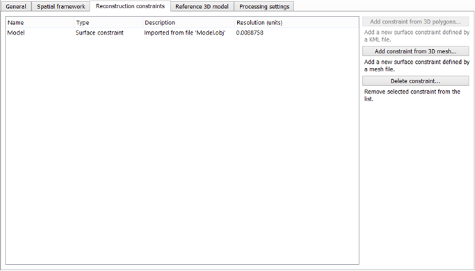
Geometry constraints
The Geometry constraints tab allows the use of existing 3D data to control the reconstruction and avoid reconstruction errors.
Geometry constraints are available only in ContextCapture Center Edition. See Software Editions.
In some cases, the automatic reconstruction may have reconstruction errors that need to be fixed. It may occur for instance on unseen areas, on reflective parts or on water surfaces.
Rather than fixing problems after the reconstruction with a 3rd party tool (refer to Retouching), ContextCapture can consider existing 3D data to help the reconstruction process on areas where photos are not sufficient.
You can define geometry constraints at any time during the workflow. If the reference model already exists, tiles overlapping the reconstruction constraint will be reset: they will be recomputed in later productions, by taking into account the new geometry constraints.
ContextCapture can use geometry constraints defined from:
- A KML or a DGN file containing 3D polygons (only for georeferenced reconstructions),
- An OBJ or a GDN file
containing a 3D mesh.
For georeferenced project, the imported file can use any spatial reference system. Please select the spatial reference system and the origin accordingly.
For non georeferenced projects, the spatial reference system of the input file must correspond to that of the internal reconstruction.
ContextCapture uses this data as a soft constraint in the reconstruction process: a reconstruction constraint is used only if there is no other reliable data in the area: wherever reliable 3D information can be inferred from input photos, it will override the reconstruction constraint.