Grid Adjustment Layer Lookup Table Form
The Lookup Table Form allows you to map values in your shapefile to the adjustment values you would like to apply. For example, if you have a building shapefile that contains values like one-story, two-story you can use the lookup table to map those to 14’ and 24’ respectively.
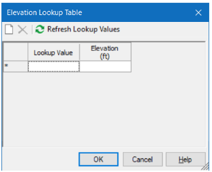
You can access the Lookup Table Form from the Grid Adjustment Layers table. Click the […] button in the Lookup Table column.
(Be sure to set Adjustment Mode to Lookup Value (from source) and choose the field that contains your lookup values).
