Importing From GEOPAK
In CivilStorm 2024, support has been added to import and export GEOPAK drainage model data. CivilStorm 2024 leverages the GEOPAK runtime, so this support is only available in MicroStation with a GEOPAK license. Import and export of GeoPAK drainage files only works in an integrated environment of CivilStorm 2024/GeoPAK/MicroStation.
A GEOPAK drainage model consists of three files:
- GPF file for drainage preferences
- DLB file which is the drainage library
- GDF file which contains the drainage model data
As with any independent set of applications, there is not a perfect mapping of the data from one system to the other. The differences are described below.
Importing GEOPAK Drainage Files
You can create a CivilStorm 2024 model by importing a GEOPAK drainage model. If you are in the same DGN file that contains the element references to the GEOPAK drainage file, the geometries for the areas and links will be derived from the MicroStation elements. If not, then the geometries will be limited to whatever is available in the GDF file.
CivilStorm 2024 utilizes the following mappings between GEOPAK for importing:
Library Objects:
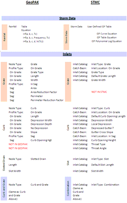
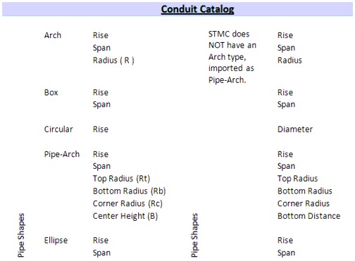
For the elements the following mappings are used:
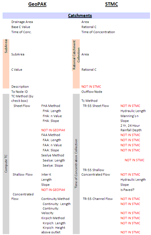
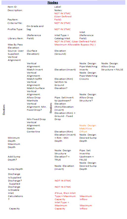
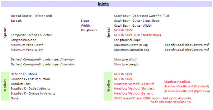
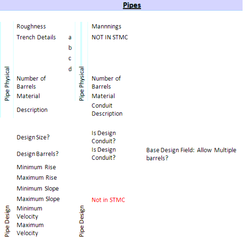

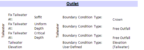
Other values that may not necessarily map directly into CivilStorm 2024 are brought in as User Defined Attributes. Some of these attributes include Network Name, Pay Items and Pay Item Descriptions. These attributes can be used in FlexTables, Queries and Reports in CivilStorm 2024.
Exporting to GEOPAK Drainage Files
You can create or update a GEOPAK Drainage File library and drainage file using this command. If the CivilStorm 2024 model was created using GEOPAK import, you will be prompted if you want to sychronize back to those files. Otherwise, you can create these files from scratch.
Note that you are prompted for two files, first is the DLB or drainage library in GEOPAK, second is the GDF or GEOPAK drainage file. There are also no MicroStation elements created from this export command, only the file data is written.
The mapping is the inverse of that described above.
Additional
There are two additional commands available as keyins only. You can import and export only library data (storm data, conduits catalogs and inlet catalogs) using these commands.